


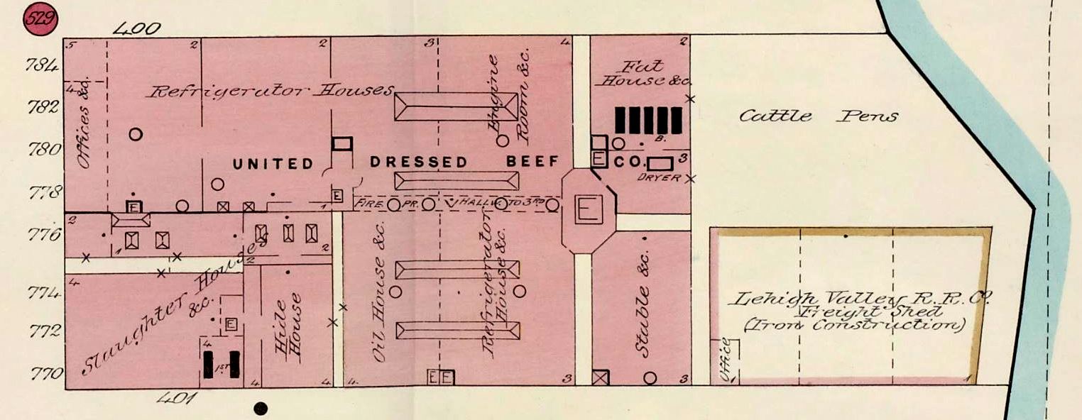
At 43rd St. and First Ave., on the same side of the street as The Cloister and The Manor, was the first of the Abattoir Center's giants, the United Dressed Beef Company. It consisted of Slaughter Houses, Hide Houses, Refrigerator Houses, Oil Houses and Fat Houses. Outdoors were the Cattle Pens, along with a freight shed for the Lehigh Valley Railroad, oddly enough.
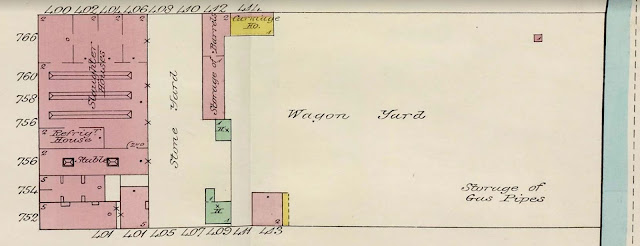 At 42nd St. and First Ave., opposite No. 45, over half of the space was given over to a Wagon Yard and the Storage of Gas Pipes. The remainder included a Stone Yard, Barrel Storage, a Carriage House, a Stable, a Refrigeration House, and Slaughter Houses.
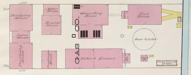 At 41st St. and First Ave., opposite No. 25, lay the New Amsterdam Gas Company. It was made up of Purifying Houses, a Lime House, an Engine House, a Meter House, a Condenser House, a Generating House, a Retort House, and a Coal House. An ominous-looking circle was identified as a Gas-holder.
 At 40th St. and First Ave., opposite No. 5 and also part of the New Amsterdam Gas Company, were five more Gas-holders, two Coat Houses, and in the smaller circles, Naphtha Tanks, buried underground.


In 1901, the New York Edison Company took over the land and opened a power plant with a slightly different footprint. It was decommissioned in 2005, and the three-block-long tract has lain vacant ever since.
It’s truly wonderful to see what proceeded us so long ago.
ReplyDeleteMay it remain forever vacant!
ReplyDelete